Photo Credit: Weather.gov 
Photo Credit: Weather.gov
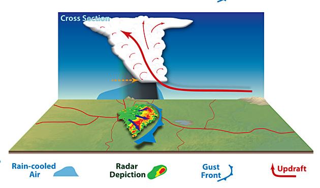
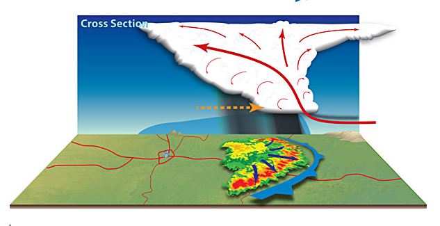
Bow Echo: A bow echo is the characteristic radar return produced by a thunderstorm’s downdraft that is shaped like an archer’s bow. According to the National Weather Service a bow echo “is based on how bands of rain showers or thunderstorms “bow out” when strong winds, associated with the storms, reach the surface and spread horizontally.” The fast-spreading wind is called a gust front and if the gust front shows “bowing” it is called a bow echo.
The rain-cooled air from the thunderstorm is denser and forces warmer moist air to rise and can create more thunderstorms. The new thunderstorms replace the older ones and produce reinforcing cool air to the gust front. The new thunderstorms will keep the gust front going.
Derecho: Once the cluster of well-organized thunderstorms (bow echo or series of bow echos) travels more than 250 miles with widespread wind gusts of 58 mph or greater it then would be classified as a derecho.


