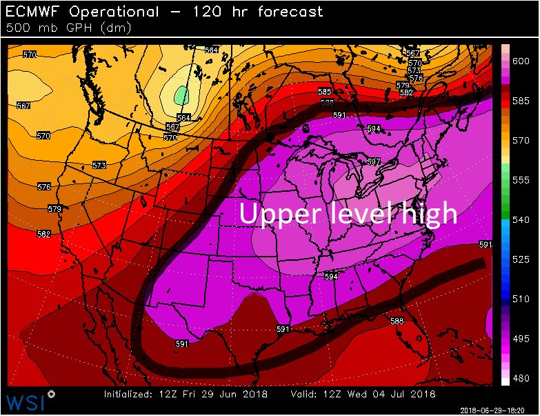
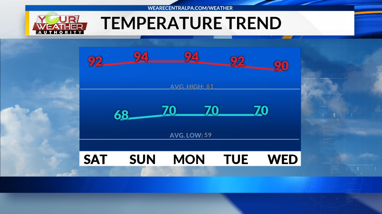
Extreme heat is forecasted for Central PA from this weekend through the middle of next week. We have 5 days in a row that are forecasted to get to 90 degrees or higher, but they won’t get to the record high temperatures that are in the middle to upper 90s and even 100 degrees. This is the longest stretch of days at or above 90 degrees since we had 6 days in July of 2016.
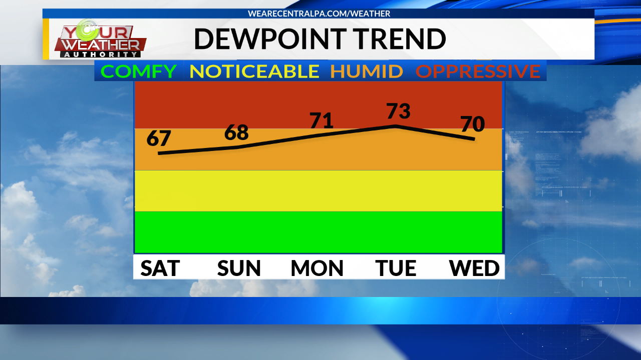
Now not only will it be hot it will also be humid as a ridge of high pressure will bring plenty moisture into our area.
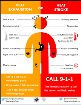
This will lead to a high heat index, which can lead to heat exhaustion and heat stroke.
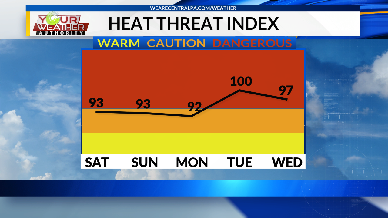
The Heat Index is calculated by using the high temperature along with the dewpoint temperatures.
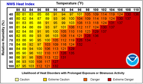
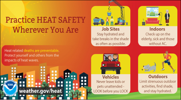
In order to be safe in extreme heat you need to limit your time outside. Do the hard labor during the early morning or the late evening. Drink plenty of water and take plenty of breaks. Try to get into air conditioning or shade as much as possible. Below there are tips for Heat Safety and the difference between heat exhaustion and heat stroke and what need to be done for each.
The ridge of high pressure will start to move into the area Friday and will continue through the middle of the following work week. The models we see below are the 500 mb heights off of the European model from Saturday through Wednesday morning. Saturday the ridge is forecasted to be over the region.
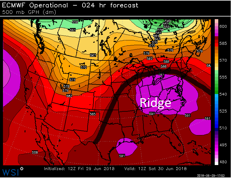
As we head into Sunday the European Model is showing the ridge is over the area.
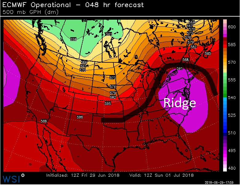
On Monday the ridge of high pressure starts to break down and is transitioning to an upper level high.
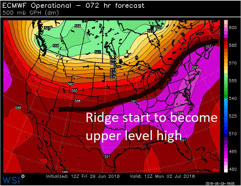
Then by Tuesday the European Model is showing an upper level high over the eastern two thirds of the country.
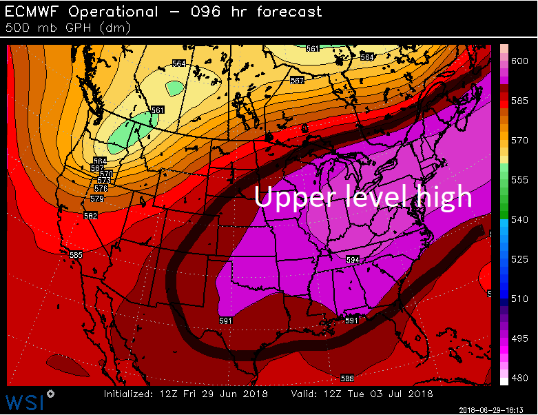
The Upper Level High Pressure is still holding strong over the region on Wednesday.
